
A pocket-sized guide
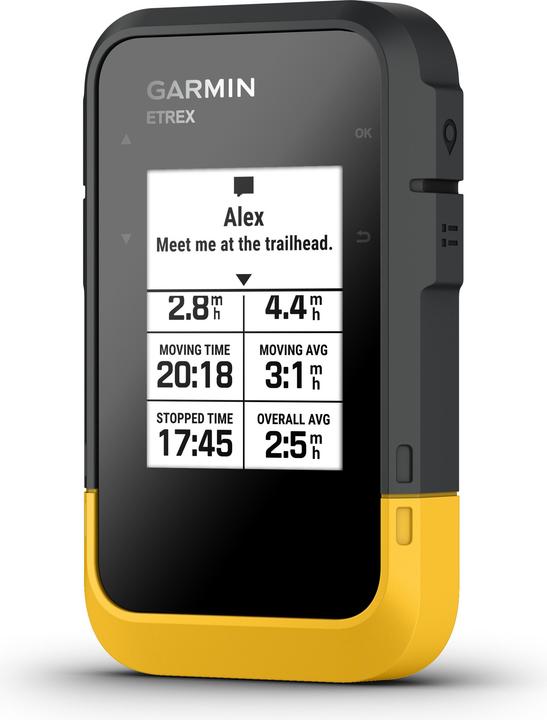
Smartphone navigation apps such as Google Maps have long since gained a foothold in everyday life and situations behind the wheel. However, when it comes to hiking, they’re not ideal. That’s why I tried out the Garmin Etrex SE navigation device – which turns out to be really useful.
You may also be wondering why a GPS device is necessary at all when a whole range of smartphone apps offer good navigation services. But if you’re at all interested in outdoor topics, you’ll keep coming across reports about hikers (site in German) who allegedly got into danger as a result of trusting Google Maps. In the meantime, Google Maps reportedly adjusted the routes in question.
Nevertheless, smartphones aren’t ideal for navigating in the great outdoors. For one thing, the battery runs out quite quickly when using GPS. Besides, GPS devices are much more robust than conventional smartphones. After all, the latter are designed with outdoor use in mind. That’s why they cope well with icy cold, bright sunlight, mud and being dropped occasionally.
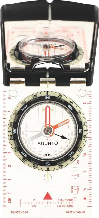
It goes without saying that you should always take a compass and map with you on outdoor adventures, regardless of what electronic devices you have. I use the Suunto MC-2 Global and swisstopo maps, which I reckon are particularly good for route planning.

However, old school navigation can be difficult in rain, wind and fog. In situations like these and many others, a portable GPS device makes perfect sense. For instance, if you want to establish your position quickly in a dangerous situation so you can let others know. Equally, it can also be convenient for following a route while hiking and biking or taking a note of your own route. I tested the compact Garmin Etrex SE, launched this year, for the last two scenarios.
First steps with the Garmin Etrex SE
The Garmin Etrex SE is a device for purists. It boasts a sharp, black-and-white liquid crystal display (LCD) that’s easy to read even in bright sunlight and is extremely energy-efficient. This means you’ll have to forego topographical and colour maps of the terrain, but you’ll be rewarded with very long battery life.
My holiday to the Azores seemed the ideal testing ground for this device. First off, I don’t know my way around and I also don’t know if the hiking trails are well signposted.
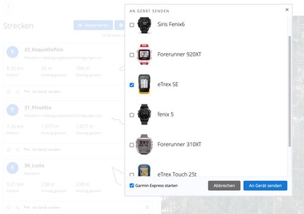
Conveniently, the travel guide lists GPS hiking routes that can be downloaded from a website. Transferring the routes to my device was a walk in the park. I opened the routes in the Garmin Connect app on the computer and sent them to the sat nav using a USB-C cable and the Garmin Express software. So I could see at a glance which route was which, I renamed them beforehand. Garmin Connect can import routes in GPX or TCX format. It’s worth noting that other extensions such as KML don’t work.
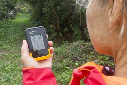
Source: Stefan Munsch
I followed the route on the IPX7-rated (site in German) waterproof device in intermittent fog and rain. This worked really well because although the hiking trails are usually marked with yellow and red lines, there were a few places where it wasn’t clear where to go next. I didn’t see any signposts here like I would in Switzerland indicating the next town and expected walking time. But as long as I followed the black line on the sat nav, I stayed on the right track. If I deviated too far from the planned route, the display initially showed a dashed line followed by a warning. This enabled me to return back on this round trip to where I’d started.
Easy and intuitive
As well as navigating a predetermined route, the Garmin Etrex SE can also record and save trails using the tracking feature, which I utilise on my morning run. I’ve set waypoints at particularly photogenic viewpoints I might like to snap shots of at sunrise or sunset the next time I visit the island. It was as simple as pressing a button.
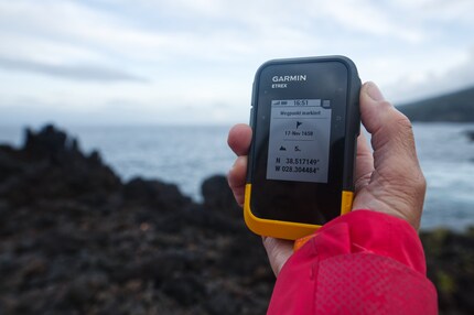
Source: Stefan Munsch
In fact, I really like the menu navigation with large buttons on the side. It’s so intuitive that I can switch back and forth between the main and sub-menu in a flash and retrieve information on altitude and route length.
Another useful feature is the Back to Start feature, which, as the name suggests, returns you to your starting point, either along your previous route or as the crow flies. This obviously requires you to have the tracking feature switched on. You can do this actively at the start of every hike at the touch of a button. Alternatively, you can activate the automatic tracking feature, which starts as soon as you switch on the device and set off. The device has an electronic compass just in case and to ensure optimal orientation.
Connect to your computer or via the app
I used the Garmin Connect website on my computer (Mac Mini) to access the hiking routes from the guidebook. This is also where I set my waypoints with a click of the mouse and created my route. With the Send to device feature, transferring is a breeze when you use a USB-C cable.
Source: Siri Schubert
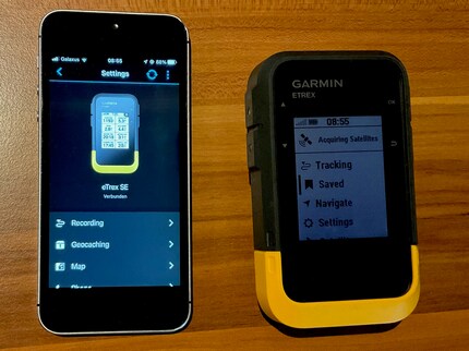
It looks slightly different when you connect via a smartphone. While I can hook the Etrex SE up to my iPhone via the Garmin Connect app, I still had to download the Garmin Explore app to create routes and export them from the device.
Source: Siri Schubert
By tapping the screen when zooming in and out of the map, I accidentally set waypoints that I then had to go back and delete. What’s more, sending to the device isn’t altogether intuitive. I first had to save the route under Library and then synchronise the GPS with my iPhone. I’d have preferred a simple Send to device button. Moreover, there’s no option to connect to additional external sensors via ANT+ or Bluetooth.
Robust battery life for multi-day trips
The device really goes places when it comes to battery life. According to the manufacturer, it packs in 168 hours, in other words a whole seven days. In expedition mode, which saves fewer track points and deactivates Bluetooth, it’s even said to last up to 1,800 hours. After a 3-hour hike, a 12-kilometre run, setting various waypoints and synchronising with the app, the battery indicator still shows it’s full. What I particularly like is that the device runs on conventional AA batteries – rechargeable or throwaway. I prefer the former, but if I’m out and about and forget to charge them, I can find replacements at almost any supermarket or petrol station.
Various international satellite systems
Positioning and route guidance is extremely precise and works with the international GPS, GLONASS, Galileo, BeiDou and QZSS systems. When I put the device through its paces, the route guidance in multi-GNSS mode, where it’s connected to at least four satellites, was incredibly precise. Once I zoomed in on the route on the 2.2-inch display, I could spot exactly when I deviated from the path.
Verdict: a handy navigation tool with useful features
The Garmin Etrex SE is a solid basic-level GPS device for hiking, biking and kayaking trips. Weighing around 160 grammes and measuring 6.1 × 10 × 3.3 centimetres, it fits comfortably in your hand. Its strengths include the bright, easy-to-read 2.2-inch display with 240 × 320 pixel resolution and long battery life thanks to AA batteries. According to Garmin, the 28 MB memory supports up to 1,000 waypoints, 50 routes and 200 activities. However, if you prefer maps in colour rather than black-and-white as well as a messenger feature similar to that in the Garmin InReach Mini 2 and the ability to hook up to heart rate monitors or temperature sensors, this device won’t make the cut.
Header image: Stefan Munsch
Research diver, outdoor guide and SUP instructor – I love being in, on and around water. Lakes, rivers and the ocean are my playgrounds. For a change of perspective, I look at the world from above while trail running or flying drones.
These articles might also interest you

Product test
Outdoor gadget HMD OffGrid: Satellite subscription with certain advantages
by Michael Restin

Background information
Last year the Garmin InReach helped many hikers in emergency situations
by Siri Schubert

Product test
With sat nav for the night sky: the Celestron StarSense Explorer LT 70 AZ entry-level telescope
by Michael Restin
